
When strategic planners in New Delhi discuss the Nimmu–Padum–Darcha (NPD) road, the language is precise and logistical: a 298-kilometer-long, two-lane paved road linking NH3 at Darcha in Himachal Pradesh to NH301 at Padum and NH1 at Nimmu in Ladakh. On October 15, 2026, when Prime Minister Narendra Modi officially dedicated this corridor to the nation, defense analysts celebrated the completion of Ladakh’s third major access axis alongside the Srinagar–Leh and Manali–Leh highways. Shielded deep behind the Zanskar and Great Himalayan ranges—far from international border observation and bypassing the multi-pass gauntlet of the traditional Leh–Manali highway, it offers a shorter, safer year-round strategic alignment for both military and civilian mobility.
Yet for the engineers and local laborers of the Border Roads Organisation (BRO) who blasted through vertical quartz walls along the Zanskar Gorge and laid asphalt up to 16,558 feet at Shinkun La, this road represents more than defense logistics. Stand by the steel bridge at Darcha or beside a whitewashed chorten in Padum, and the road reveals its true impact: the physical mending of an ancient, severed lifeline between Himachal Pradesh and Ladakh.
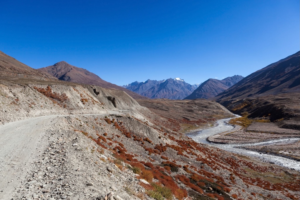
The sheer scale of the terrain carved out by the BRO along the river corridor illustrates why this link took decades to realize:
The Southern Gateway: How Lahaul Is Evolving
For decades, the Lahauli villages of Jispa and Darcha along the Bhaga River were brief acclimatization halts where travelers paused for a night before tackling Baralacha La on NH3. With the inauguration of the NPD axis, Darcha has transformed overnight from a quiet wayside stop into one of the most important highway bifurcations in the western Himalayas.
At the Darcha bridge checkpost, where gravel tracks and mule paths once marked the end of motorable Himachal, stone-and-timber dhabas, tire repair sheds, and family guesthouses are expanding to meet year-round movement. In the district headquarters of Keylong, mechanics and fuel station crews at Tandi are gearing up for a surge in overlanders heading north into Zanskar. Meanwhile, local taxi unions in Manali, Keylong, and Padum are working out reciprocal transit agreements so travelers can hire vehicles across state and union territory lines without mid-pass transfers.
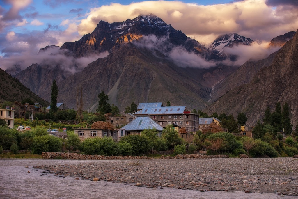
Just south of the Darcha bifurcation, riverside settlements like Jispa serve as the primary staging and acclimatization ground on the Himachal side:
For Lahaul’s agricultural cooperatives, the road opens an entirely new compass direction for trade. Farmers across the Pattan and Bhaga valleys, renowned for high-altitude seed potatoes, crisp cauliflower, and sweet green peas—previously shipped their harvest exclusively south through the Atal Tunnel toward Kullu and Chandigarh. Now, Lahauli pickup trucks can haul fresh crate loads directly over Shinkun La into the markets of Padum in a single morning.
The Reconnection of Blood and Monasteries
Long before modern district borders divided Himachal Pradesh and Ladakh, Lahaul and Zanskar functioned as sister valleys bound by Tibetan-Buddhist lineages, shared dialects, intermarriage, and monastic networks. Every autumn before the heavy snows of Diwali and Losar, traders and monks crossed Shinkun La on foot with pack horses. Once November buried the pass, the door slammed shut for seven months. Monks from Kardang and Guru Ghantal Gompas in Lahaul lost contact with sister institutions like Karsha, Stongdey, and Phuktal in Zanskar, and families separated by a mere 140 kilometers could neither gather for winter weddings nor mourn together at funerals.
The BRO’s paved corridor collapses that seasonal divide. A journey across glaciated moraines that once took five days on foot now takes a few hours by utility vehicle whenever the pass is clear. Cultural travelers and local pilgrims alike can now time their journeys with the vibrant summer and autumn Gustor (sacred masked dance) festivals at Sani, Karsha, and Stongdey monasteries, while cliffside sanctuaries that once required a multi-day trek from the nearest roadhead are now accessible via short trail approaches from the main highway.
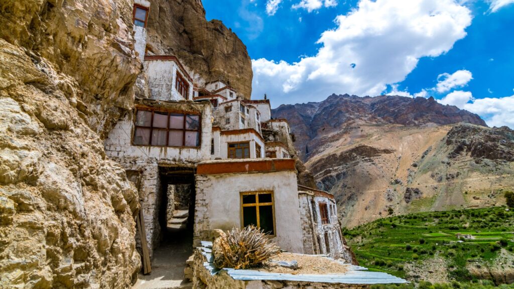
Built directly into a natural limestone cavern above the Tsarap River, Phuktal Gompa is now within a day hike from the road head near Purne:
Decentralizing the Tourist Footprint & New Adventure Circuits
For years, tourism in Ladakh suffered from an out-and-back bottleneck centered on Leh. Visitors flew in, crowded the roads to Pangong Tso and Nubra Valley, and left peripheral valleys economically sidelined. By linking NH3 (Manali–Leh) directly to NH301 (Padum–Kargil) and NH1 (Srinagar–Leh), the NPD road converts the trans-Himalaya into a continuous loop:
Manali (NH3) → Atal Tunnel → Darcha → Shinkun La → Padum (NH301) → Nimmu (NH1) → Leh
Instead of funneling money solely into urban hotel chains, this circuit spreads income directly to high-altitude hamlets along the Lungnak and Zanskar rivers. In villages like Kargyak, Purne, Amnu, Zangla, Nerak, and Chilling, families are converting traditional mud-and-stone farmhouses into homestays, serving hot butter tea, barley tsampa, and thukpa to passing travelers.
Beyond road-tripping, the highway acts as a launchpad for an expanded adventure ecosystem:
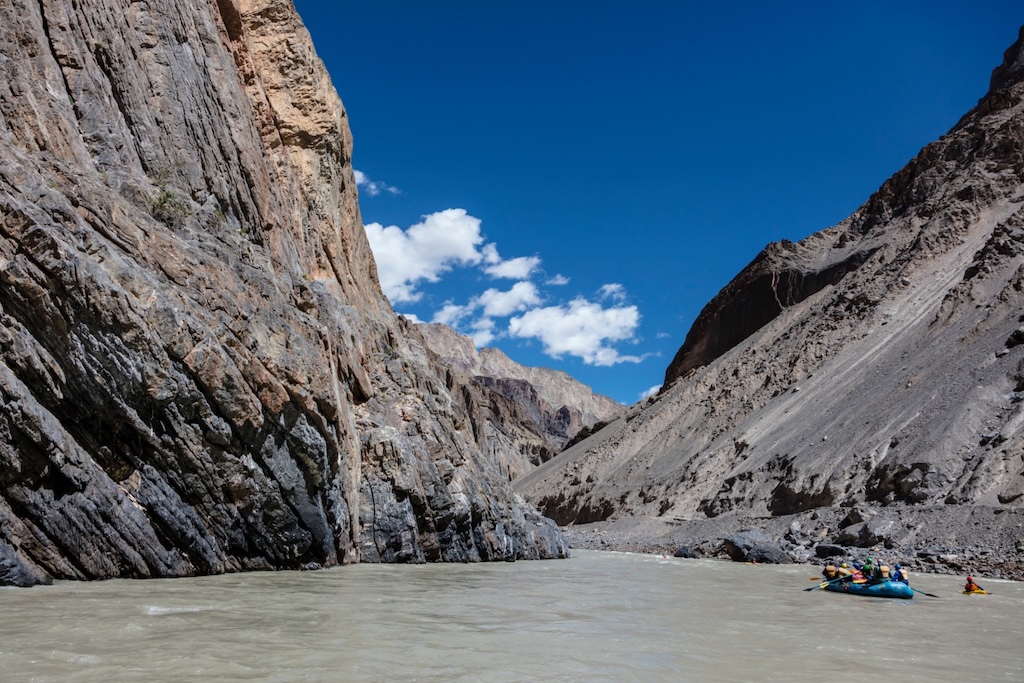
- White-Water Rafting & Kayaking: Navigating the deep defile of the Zanskar River between Padum and Nimmu—often called the “Grand Canyon of Asia”—used to require grueling multi-day gear hauls via Kargil. Outfitters can now shuttle rafts, kayaks, and safety crews directly along the gorge road to put-in points at Remala, Padum, and Chilling.
- High-Altitude Bikepacking: Cyclists looking to escape the heavy military and cargo truck convoys of Baralacha La and Tanglang La are adopting the Darcha–Padum–Nimmu corridor as the premier trans-Himalayan bikepacking route.
- Mountaineering & Side-Valley Treks: While the road has shortened old valley-floor treks, it gives climbers and trekkers rapid trailhead access to unclimbed side valleys, high passes linking into Lahaul’s Miyar Valley, and expedition base camps around the Zanskar range.
Deep inside the canyon between Padum and Nimmu, rafters navigate Grade IV rapids framed by towering vertical rock walls alongside the new corridor:
Daily Life: Fresh Greens and Medical Realities
The most transformative dividends of the NPD road are felt in village kitchens and rural health clinics. Historically, winter in Zanskar meant seven months of strict rationing on dried turnip greens, parched barley flour, and pulses stored before the passes closed. Goods trucked via Srinagar and Kargil carried steep transport markups. With a direct two-lane link from Himachal, fresh produce from Kullu and Lahaul, LPG cylinders, and building timber reach Padum at lower prices and in half the transit time.
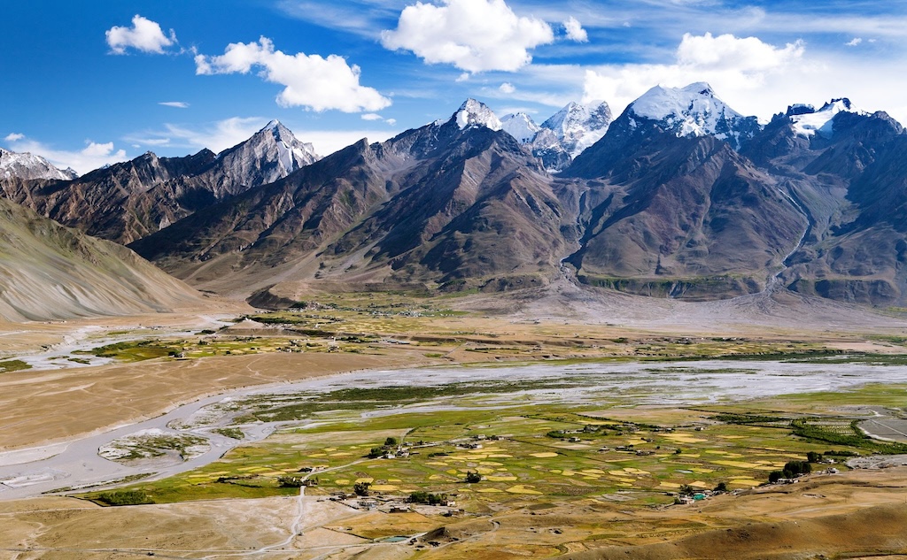
Around Padum, where green barley fields meet the braided channels of the Stod and Tsarap rivers, the road ends centuries of supply-chain isolation:
Just as importantly, emergency medical care no longer depends entirely on whether an Indian Air Force helicopter can land through winter cloud cover. Expectant mothers facing complications, trauma patients, and elderly residents in Padum or Kargyak can be driven across to district hospitals in Keylong, Kullu, or Leh without waiting days for weather windows to clear.
The Ecological and Cultural Crossroads
Progress on this scale does not arrive without local soul-searching. Across Zanskar, elders and youth associations are weighing economic opportunity against ecological fragility.
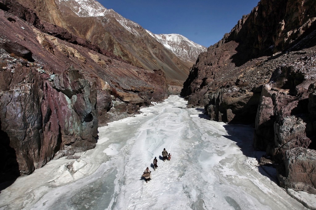
Nowhere is this shift more poignant than on the Chadar Trek. For centuries, when winter temperatures dropped to -30°C, the frozen sheet of the Zanskar River was the only emergency footpath connecting Padum to the outside world at Chilling—and in recent decades, a bucket-list winter trek supporting hundreds of local porters and guides. Between road blasting along the gorge walls, rockfall debris, and shifting winter temperatures, the continuous ice formation has fractured, effectively bringing the era of the traditional river walk to a close as tires replace ice cleats.
For generations of Zanskari families, walking the frozen surface of the Zanskar River was the sole winter passage out of the gorge:
Local Panchayats and youth groups in both Darcha and Padum are also mobilizing to prevent the waste and water crises that have strained Leh and Kasol. Because high-altitude villages rely on delicate glacial meltwater channels (yuras), community boards near the sacred monolith of Gonbo Rangjon and at village entries are enforcing strict codes of conduct: banning single-use plastics, restricting unruly off-road driving across alpine grazing meadows, and requiring campers to pack out all waste.
Practical Briefing: Driving the NPD Axis Today
Before turning your wheels north from Darcha or south from Nimmu, keep these operational ground rules in mind:
- Current Status (Seasonal / Fair-Weather Road): While the 298 km corridor is fully connected and paved, the crossing over Shinkun La Pass (16,558 feet) remains vulnerable to blizzards, black ice, and rockfall restrictions near the gorge sections. Full 365-day, all-weather connectivity will only be achieved once the 4.1 km twin-tube Shinku La Tunnel is completed (targeted for 2028–2029). Always verify daily pass status at the Darcha and Padum police checkposts.
- The Acclimatization Rule: Never drive directly from Manali (2,050 m) over Shinkun La (5,047 m) in a single day. That rapid 3,000-meter altitude jump carries a severe risk of Acute Mountain Sickness (AMS). Spend at least one night acclimatizing in Lahaul at Keylong, Jispa, or Darcha (3,300–3,500 m) before ascending the pass.
- Fuel & Mechanical Readiness: Fill your tank to capacity at Tandi or Keylong on NH3. The next reliable commercial fuel station is in Padum (roughly 140 km away across high altitude), followed by Karu/Leh or Nimmu on NH1. A high-ground-clearance SUV, 4×4, or well-prepped adventure motorcycle is recommended for tackling water crossings and frost-heaved sections near the pass.
- Respecting Sacred Landscapes: As you descend from Shinkun La into the Lungnak Valley, you pass directly beneath Gonbo Rangjon, a towering, standalone rock peak revered by locals as a guardian deity. Camping on its immediate slopes, flying drones over monastic retreats, or leaving litter along prayer walls is strictly prohibited.
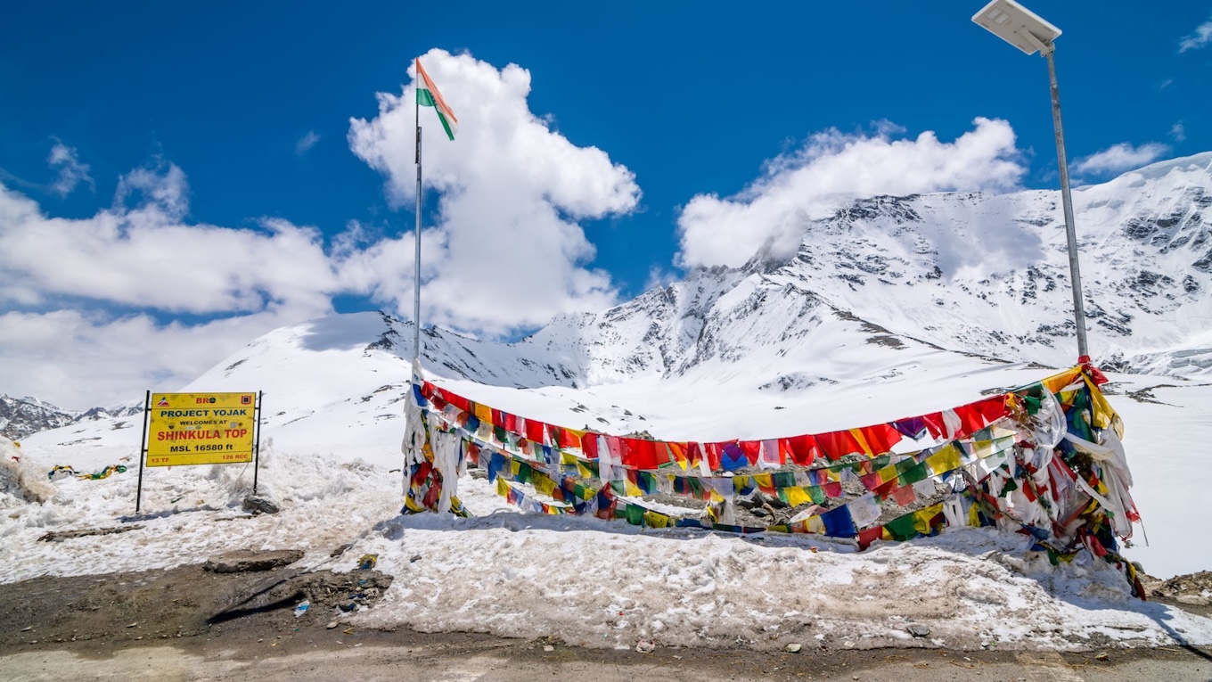
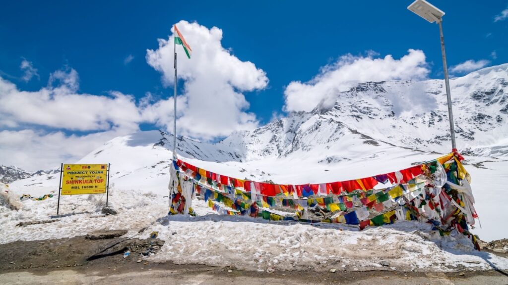
At the 16,558-foot crest of Shinkun La, prayer flags and BRO signboards mark the high-altitude threshold between Himachal Pradesh and Zanskar:
Planning Your Trip Along the Zanskar Highway?
Whether you are mapping out a trans-Himalayan motorcycle circuit, a family 4×4 expedition, or a trek into the side valleys of Zanskar and Lahaul, timing and preparation make all the difference on this route. Drop a comment below with your vehicle type (bike, 4×4, or standard car) and your target travel dates, and our local route team will share tailored pass-opening windows, homestay recommendations, and fuel-stop tips for your journey.